Black Hills National Forest: A Complete Visitor Guide
Black Hills National Forest covers roughly 1.2 million acres across western South Dakota and northeastern Wyoming, stretching about 110 miles long and 70 miles wide. It is managed by the USDA Forest Service and holds more than 175 recreation sites, including developed campgrounds, reservoirs, scenic byways and hundreds of miles of trail. Visitors come for hiking, camping, fishing, mountain biking and off-highway vehicle riding, and the forest wraps around better known landmarks such as Mount Rushmore National Memorial and Custer State Park. Most areas are open year round, though access and services shift heavily by season.
This guide covers what the forest contains, how to plan a trip around it, and the practical details that trip up first time visitors.
The Forest at a Glance
| Detail | Information |
| Size | Approximately 1.2 million acres |
| States | Western South Dakota and northeastern Wyoming |
| Dimensions | Roughly 110 miles long by 70 miles wide |
| Managing agency | USDA Forest Service, Rocky Mountain Region |
| Supervisor’s office | 1019 N. 5th Street, Custer, SD 57730, (605) 673-9200 |
| Recreation sites | More than 175, including campgrounds, picnic sites, trailheads and boating sites |
| OHV trails | Over 700 miles of designated routes |
| Nearest major city | Rapid City, South Dakota |
The name comes from the Lakota “Paha Sapa,” meaning hills that are black, a reference to how the dense ponderosa pine looks from a distance across the surrounding prairie.
Understanding the Land Ownership Map
This is the single most useful thing to understand before you go, because the Black Hills is not one jurisdiction. Several agencies manage adjoining land, and the rules, fees and permits change as you cross between them.
- National forest land is managed by the Forest Service and is where most dispersed camping and general recreation happens.
- Custer State Park is a South Dakota state park and requires a park entrance license, which is separate from anything the Forest Service issues.
- Mount Rushmore National Memorial is managed by the National Park Service and has its own parking arrangement.
- Wind Cave National Park and Jewel Cave National Monument are also National Park Service units.
- The George S. Mickelson Trail is administered by South Dakota Game, Fish and Parks and requires its own trail pass.
Assuming a single pass covers everything is the most common planning mistake visitors make. Check the managing agency for each specific site you plan to visit.
Major Recreation Areas and Scenic Attractions
Once the base layer is sorted, the mid layer choice is mostly about conditions and how hard you plan to work.
Spearfish Canyon
Spearfish Canyon in the northern hills is a limestone walled canyon best known for its scenic byway, a roughly 22 mile route with pullouts and short trails. Three waterfalls draw most of the attention. Bridal Veil Falls drops around 60 feet and is visible from a roadside pullout. Roughlock Falls is a multi-tiered cascade reached by a short, gentle trail. Spearfish Falls sits below the canyon floor and is reached by a marked descent.
The canyon is at its most photographed in late September and early October, when birch and aspen turn against the dark pine. Some land around Roughlock Falls is state managed rather than national forest, so signage may reference different rules.
Pactola Reservoir
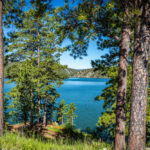
Pactola is the largest reservoir in the Black Hills, sitting along Highway 385 between Rapid City and Hill City. It offers boating, swimming, a visitor center and shoreline access, and its clear, deep water holds cold water species.
Sheridan Lake and Deerfield Lake
Sheridan Lake is closer to Rapid City, with a swimming beach, boat ramps and adjacent campgrounds, which makes it a practical family base. Deerfield Lake sits higher and quieter to the west, with a shoreline loop trail popular with hikers and mountain bikers.
Black Elk Peak and the Black Elk Wilderness
Black Elk Peak reaches 7,242 feet and is the highest point in the United States east of the Rocky Mountains. The most direct route is Trail #9, listed at about 3.3 miles one way with a moderate rating, starting near the Sylvan Lake day use area.
Two practical notes. Sylvan Lake sits inside Custer State Park, so a park entrance license is required to enter or park there. Visitors entering the Black Elk Wilderness are asked to register at the major trailhead portals and carry the registration form. Summer afternoon thunderstorms with hail and strong winds are common on the exposed summit, which is a strong argument for an early start.
Scenic Driving
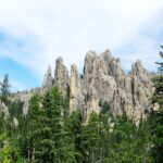
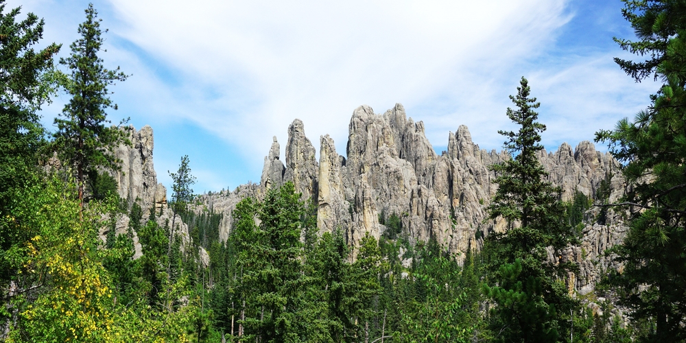
The forest is threaded with byways that make good rainy day alternatives. Iron Mountain Road, Needles Highway and the Peter Norbeck Scenic Byway are the best known, with pigtail bridges, granite tunnels and framed views. Several have low tunnel clearances that exclude large RVs and trailers, so check vehicle restrictions in advance.
Black Hills Hiking and Trails
George S. Mickelson Trail
The Mickelson Trail is the signature long distance route in the region. It runs 109 miles from Edgemont to Deadwood on a converted rail bed, crossing more than 100 converted railroad bridges and passing through four rock tunnels. The surface is crushed limestone and most grades stay under 4 percent, which makes it unusually accessible for a mountain trail.
There are 15 trailheads, each with parking, a self-service pass station, vault toilets and picnic tables. A trail pass is required and is administered by South Dakota Game, Fish and Parks. At the time of writing, daily passes are listed at $5 per person and annual passes at $20 per person, with annual passes available online. Verify current rates and any age exemptions with Game, Fish and Parks before your trip.
The trail supports biking, hiking, horseback riding, cross-country skiing, snowmobiling and snowshoeing. The 19 mile stretch from Deadwood to Dumont is the longest sustained climb, with Dumont the high point of the route.
Centennial Trail
The Centennial Trail, signed as Trail #89 on forest land, runs south to north between Wind Cave National Park and Bear Butte State Park. Published lengths vary by source, with figures between roughly 111 and 123 miles in circulation, so confirm the current official mileage with the Forest Service before quoting a number in trip plans.
The route crosses mixed grass prairie, ponderosa pine forest and granite country, and it passes through several jurisdictions, so use restrictions change along the way. Mountain biking is not permitted in the Black Elk Wilderness, and both biking and horseback riding face restrictions inside Wind Cave National Park and parts of Bear Butte State Park.
Shorter Hikes Near Mount Rushmore
For visitors basing a trip around the memorial, good short options sit nearby. Little Devils Tower offers a scrambly summit with wide views, and the Presidential Trail at the memorial is a short paved loop. Sunday Gulch, accessed from Sylvan Lake, is steeper and rockier, and it closes seasonally when ice makes the handrails hazardous.
Trail Planning Notes
- Trail conditions change quickly after storms and during spring melt.
- Cell coverage is unreliable, so download offline maps.
- Water sources are limited on ridge routes.
- Check the Forest Service alerts page for closures and fire restrictions.
Camping in South Dakota's Black Hills
Developed Campgrounds
The forest operates around 30 developed campgrounds spread across the South Dakota hills and the Bearlodge Mountains in Wyoming. Reservation policy is not uniform. Some campgrounds take reservations through Recreation.gov, while others such as Boxelder Forks and Castle Peak operate first come, first served. Popular sites near Rapid City and the reservoirs fill early on summer weekends.
Fees vary by site and some campgrounds offer reduced off-season rates. The Forest Service publishes seasonal campground opening and closing information, which is worth checking because many sites shut down water service well before they close entirely.
Dispersed Camping and the Occupancy Limit
Dispersed camping is permitted in much of the forest outside developed sites, but it is governed by a specific occupancy order. The current order prohibits camping or occupying Black Hills National Forest land for longer than 14 calendar days, including portions of days, within a continuous 28-day period. That order took effect August 8, 2026 and runs through December 31, 2031.
Fire restrictions are a separate and more changeable matter. Stage 2 fire restrictions were in effect across the South Dakota and Wyoming portions of the forest as of late July 2026, with fire danger rated very high in the northern hills and extreme in the central and southern hills. Fire restriction status changes within a season and sometimes within a week.
Flagged for local review: fire restriction stage, campground opening dates, current fee schedules and any active closures must be re-verified against the Forest Service alerts page immediately before this article is published, and reviewed on a seasonal schedule afterward.
Fishing in the Black Hills
Western South Dakota is the state’s trout country. Cold, spring-fed streams and stocked reservoirs hold rainbow, brown and brook trout, and larger reservoirs support additional cold water species.
Rapid Creek and Spearfish Creek are the best known moving water, and Pactola, Sheridan and Deerfield are the reservoirs most anglers name first. A South Dakota fishing license is required for adults, and license types, daily limits and any water specific rules are published by South Dakota Game, Fish and Parks.
Aquatic invasive species rules apply statewide and are strictly enforced. Trailered boats must have drain plugs and other drainage devices opened or removed except while launching or loading, and lake or river water must not be transported away from the access area. External felt soled waders and boots are not permitted in South Dakota waters, which catches out visiting anglers regularly.
For a fuller breakdown of waters, species and seasonal tactics across the state, see “where to fish across South Dakota”
Things to Do in Rapid City as a Base
Rapid City is the practical hub for most Black Hills trips. It has the region’s main airport, the widest range of lodging, and the shortest drives to the eastern side of the forest.
- It works as a supply stop for groceries, fuel and last minute gear.
- Downtown has a walkable core with the City of Presidents statues at street corners.
- Museums and family attractions give you a rain day option without leaving town.
- Mount Rushmore, Sheridan Lake and Pactola all work as day trips.
If you want one base for a three or four day trip, Rapid City is usually easiest. If your priority is the northern hills and Spearfish Canyon, staying in Spearfish or Deadwood cuts significant driving.
Seasonal Trip Planning
| Season | What to expect | Best for | Watch out for |
| Spring, April to May | Variable weather, snow still possible at elevation, high stream flows | Quiet trails, waterfalls at strong flow | Mud, late snowstorms, some campgrounds still closed |
| Summer, June to August | Warm days, afternoon thunderstorms, peak visitation | Swimming, boating, full campground services | Storms on exposed peaks, crowds, fire restrictions |
| Fall, September to October | Cool mornings, warm afternoons, fall color in the canyons | Hiking, photography, scenic drives | Rapid temperature swings, hunting seasons opening |
| Winter, November to March | Cold, snow at elevation, reduced services | Snowshoeing, cross-country skiing, snowmobiling | Road closures, limited facilities, short daylight |
What to Pack and Wear
Conditions here reward adjustable clothing. Mornings start cold in the canyons, afternoons heat up on exposed ridges, and summer thunderstorms build fast.
Sun exposure on open ridgelines is stronger than most visitors expect. A hooded long sleeve like the OC Sun Shirt, built from a lightweight 92 percent polyester and 8 percent spandex knit rated UPF 50, covers the neck and forearms without the heat of a heavier shirt. For warmer, shorter outings, a moisture-wicking option such as the Original OC Performance T-Shirt handles sweat better than cotton.
Wind is the other constant, particularly on ridgelines and around Bear Butte. A packable shell such as the Spring Tide windbreaker in 100 percent polyester takes up little room and cuts wind chill significantly. It is not described as waterproof, so pack a dedicated rain shell for storm season.
For cold mornings and evenings, an insulated puffer vest keeps your core warm while leaving your arms free. Around camp in dry conditions, the Dark Canyon Hoodie in 380 GSM cotton fleece is a comfortable evening layer, though cotton fleece is a poor choice for hiking in rain. The wider men’s outdoor apparel range shows how these pieces stack together.
For a full head to toe seasonal breakdown, see“a season by season guide to hiking clothing” If you want the technical reasoning behind fabric choices, see “how the three layer system works”
Day Trip Packing Checklist
- Layered clothing with a wind shell, packed even on clear mornings
- More water than you think you need, plus a filter for longer routes
- Offline maps downloaded before you lose signal
- Sun protection including hat, sunglasses and sunscreen
- Headlamp, first aid kit and a small repair kit
- Bear aware food storage habits and a trash bag for pack out
- Trail pass or park entrance license appropriate to the site
Wildlife and Trail Safety
The forest supports elk, mule deer, white-tailed deer, bighorn sheep, mountain goats, mountain lions and a small bison presence in adjoining parks. Encounters are usually uneventful if you give animals space and never approach or feed them.
Practical Safety Points
- Bison in Custer State Park are unpredictable and cause more visitor injuries than any predator. Stay in your vehicle when herds are near the road.
- Mountain lions are present but rarely seen. Hike in groups where possible, keep children close, and do not run if you encounter one.
- Prairie rattlesnakes occur at lower elevations. Watch hand placement on rock and stay on trail in tall grass.
- Summer lightning is a genuine hazard on Black Elk Peak and other exposed summits. Plan to be off high ground by early afternoon.
- Ticks are active in spring and early summer. Check thoroughly after hiking in brush.
- Fall brings active hunting seasons on national forest land. Wear bright colors and check season dates before hiking in October and November.
Responsible Recreation
The Black Hills absorb heavy visitation, and the difference between a forest that holds up and one that degrades comes down to ordinary habits.
- Pack out everything you bring in, including food scraps and toilet paper.
- Stay on designated trails, especially in wet conditions when trail widening happens fastest.
- Keep motorized use to designated OHV routes on the current motor vehicle use map.
- Respect fire restrictions completely. Stages reflect measured conditions, not caution for its own sake.
- Camp on durable surfaces and follow posted setback distances from water.
- Treat the Black Hills as a place of cultural and spiritual significance to the Lakota and other Native nations, particularly at Bear Butte, where ceremonies are ongoing and posted etiquette should be followed.
Suggested Itineraries
One Day in the Black Hills
- Early start from Rapid City, drive to Sylvan Lake.
- Hike Trail #9 to Black Elk Peak and back, allowing four to five hours with stops.
- Drive Needles Highway to Custer, stopping at pullouts.
- Late afternoon visit to Mount Rushmore National Memorial.
- Return to Rapid City for the evening.
This is a full day. If you would rather skip the summit hike, swap step two for the Sylvan Lake shore loop and add Iron Mountain Road.
Three Days in the Black Hills
Day one, southern hills. Sylvan Lake, Black Elk Peak, Needles Highway, Mount Rushmore in the late afternoon.
Day two, central hills and water. Morning on the Mickelson Trail out of Hill City or Custer, afternoon at Pactola or Sheridan Lake for swimming or fishing, evening in Hill City or Rapid City.
Day three, northern hills. Drive Spearfish Canyon, walk to Roughlock Falls and Bridal Veil Falls, continue to Deadwood, and finish with a short section of the Mickelson Trail from the Deadwood trailhead if time allows.
A fourth day lets you add Deerfield Lake and Bear Butte at the northern end of the Centennial Trail.
Planning a Trip to Black Hills National Forest
Black Hills National Forest rewards visitors who plan around three things: which agency manages the specific site they are visiting, what the current fire and closure status is, and how quickly the weather shifts between the plains and the high country. Get those right and the rest of the trip is straightforward.
Book campgrounds early for summer weekends, buy the correct passes for the specific sites on your list, and carry adjustable clothing rather than one heavy layer. If you want to see how a brand shaped by riding and working in these hills approaches gear, the Out Cold Outdoors story starts in this country. You can also outfit a Black Hills trip from one place before you go.
Frequently Asked Questions
Do I need a pass to enter Black Hills National Forest?
There is no general entrance fee for the national forest itself, but individual sites may charge day use or camping fees, and adjoining lands have their own requirements. Custer State Park needs a park entrance license and the Mickelson Trail needs a trail pass, both administered by South Dakota Game, Fish and Parks.
What is the best time of year to visit?
Late June through early September gives the most reliable weather and full campground services. Late September and early October are excellent for hiking and fall color with smaller crowds, though nights get cold and hunting seasons begin.
Can you camp anywhere in the forest?
Dispersed camping is allowed in much of the forest outside developed areas, subject to posted restrictions. The current occupancy order limits camping to 14 calendar days within any continuous 28-day period, and fire restrictions may further limit where and how you camp.
How long is the George S. Mickelson Trail?
It runs 109 miles from Edgemont to Deadwood on a converted rail bed, with 15 trailheads, more than 100 converted railroad bridges and four rock tunnels. Most grades stay under 4 percent and a trail pass is required.
Is Mount Rushmore inside the national forest?
Mount Rushmore National Memorial is a National Park Service unit surrounded by national forest land, not part of the forest itself. It is managed separately with its own parking arrangement, so plan for it as a distinct stop.
Editorial Sources
- USDA Forest Service, Black Hills National Forest home page, acreage, dimensions, recreation and current alerts: https://www.fs.usda.gov/r02/blackhills
- USDA Forest Service, Black Hills National Forest camping and cabins: https://www.fs.usda.gov/r02/blackhills/recreation/camping-cabins
- USDA Forest Service, 14-day camping and occupancy limit order for Black Hills National Forest: https://www.fs.usda.gov/r02/blackhills/alerts/14-day-limit-camping-occupancy-black-hills-national-forest
- South Dakota Game, Fish and Parks, George S. Mickelson Trail park page, length, trailheads, surface and pass information: https://gfp.sd.gov/parks/detail/george-s–mickelson-trail/
- South Dakota Game, Fish and Parks, Black Elk Peak and Sylvan Lake trail information sheet: https://gfp.sd.gov/userdocs/black-elk-peak2018.pdf
- South Dakota Game, Fish and Parks, Fishing Handbook, statewide rules and felt sole prohibition: https://gfp.sd.gov/userdocs/docs/fishinghandbook_online.pdf
- South Dakota Least Wanted, aquatic invasive species laws, drain plug and water transport rules: https://sdleastwanted.sd.gov/laws/default.aspx
- Black Hills and Badlands Tourism Association, Spearfish Canyon byway length and waterfalls: https://www.blackhillsbadlands.com/places/parks-monuments/spearfish-canyon/
- Centennial Trail route description and jurisdictional use restrictions, cross-checked against Forest Service trailhead listings.
- Product specifications verified against live Out Cold Outdoors product pages, retrieved September 2, 2026.
Items flagged for local review before publication: current fire restriction stage, campground opening and closing dates, Mickelson Trail pass prices and age exemptions, official Centennial Trail mileage, Custer State Park entrance license pricing, and Mount Rushmore parking arrangements. Published campground counts vary between 26 and 33 across Forest Service pages depending on whether group sites and Wyoming sites are included, so confirm the figure used before publishing.